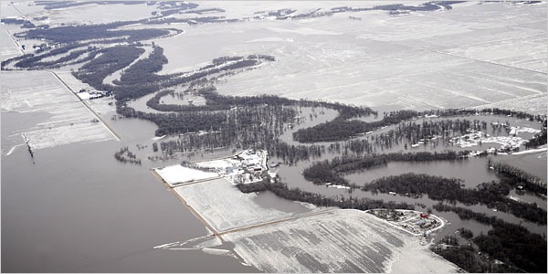
I grew up, in part, near the Red River, in Kittson County MN, closer to Winnipeg than Fargo. My chief memory of the terrain: flat. But I never realized just how flat until I read this in the NY Times this morning.
…the Red River, though fairly modest compared with some more famous rivers, [is] devilishly hard to predict, partly because of its shallow channel. The Colorado River has been carving out the Grand Canyon for millions of years. The Red, by contrast, dates back to perhaps only a few thousand years before the Pyramids. That means it has not had that long to cut deep channels that can contain water during floods.
On top of that, the river flows very slowly across a pancake-flat landscape. Imagine raising an eight-foot-long sheet of plywood just enough to slip a single sheet of paper under the raised end. The resulting minuscule tilt of the board represents the average slope of the Red River’s bed.
What that means is that the river, when it goes awry during a flood, spills every which way across the countryside.
Kennedy MN, where I lived, is about 15 miles from the river on US 75, and it wasn’t uncommon for the spring thaw to spread the river as far as that highway and beyond. The farmers in that direction, with heavy gumbo soils and late, wet springs, needed Caterpillars to draw their plows, where my uncles and cousins to the north and east of town employed conventional wheeled tractors on their lighter, sandier and better-drained fields.